 ar
ar bg
bg hr
hr cs
cs da
da nl
nl fi
fi fr
fr de
de el
el hi
hi it
it ko
ko no
no pl
pl pt
pt ro
ro ru
ru es
es sv
sv tl
tl iw
iw id
id lv
lv lt
lt sr
sr sk
sk sl
sl uk
uk vi
vi et
et hu
hu th
th tr
tr fa
fa ms
ms hy
hy ka
ka ur
ur bn
bn mn
mn ta
ta kk
kk uz
uz ku
ku
GPS Displacement Monitoring System
Kingmach GPS Displacement Monitoring System cover a broad group of displacement measurement products for civil, geotechnical, hydropower, transportation, and industrial projects. The product category includes short-range crack gauges, general-purpose displacement meters, differential displacement meters, flexible geogrid meters, multipoint rock displacement meters, single-point bedrock meters, formwork displacement meters, wire rope sensors, magnetostrictive displacement meters, and GNSS displacement devices. This range matters because displacement measurement is not one mechanical condition. A bridge joint may need 20 mm to 100 mm differential monitoring, while a draw-wire application may require 500 mm to 2000 mm travel. Some projects need embedded anchoring and grouting, while others need surface brackets, universal bases, or a cable pulled between two points. Kingmach supports these different layouts with digital output, stored calibration data, waterproof structures, and automatic acquisition compatibility. The goal is to give engineers stable movement data that can be traced from sensor body to monitoring platform. During project setup, the measuring point should be matched with the expected travel direction, available mounting space, cable route, and required acquisition interval. This prevents a short-range joint instrument from being used on a long-travel point, or an exposed sensor from being placed where an embedded anchor is needed. It also helps the monitoring team set a baseline that can be defended during acceptance and later maintenance review.
Application of GPS Displacement Monitoring System
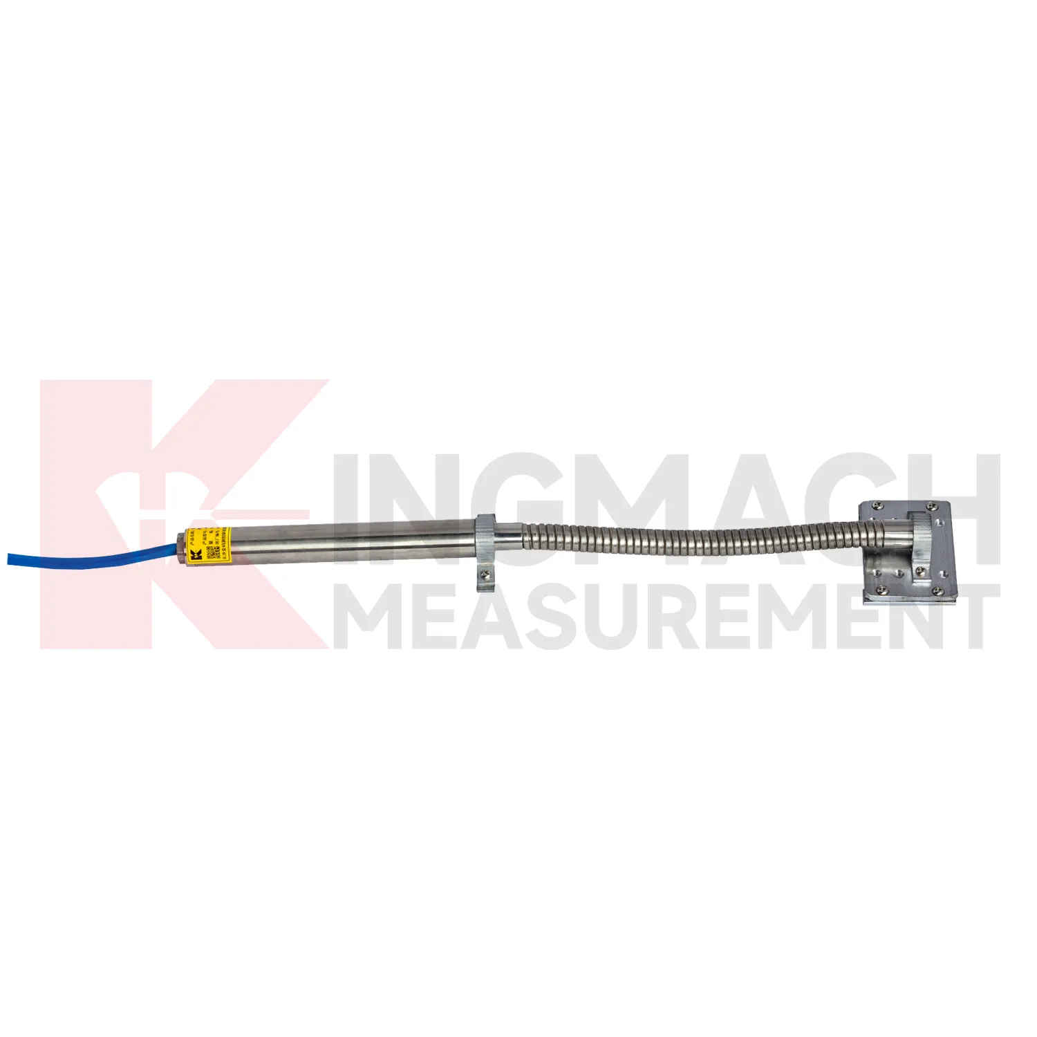
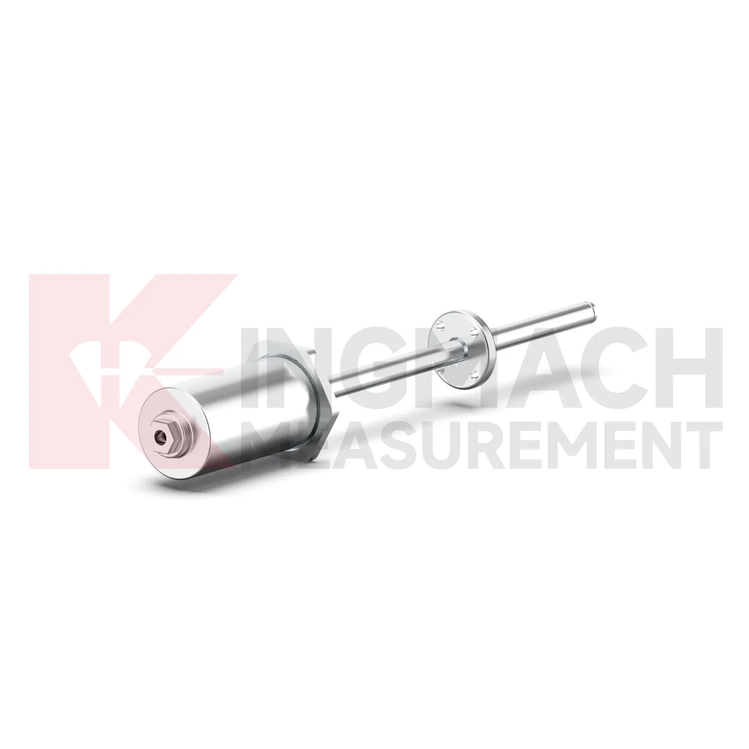
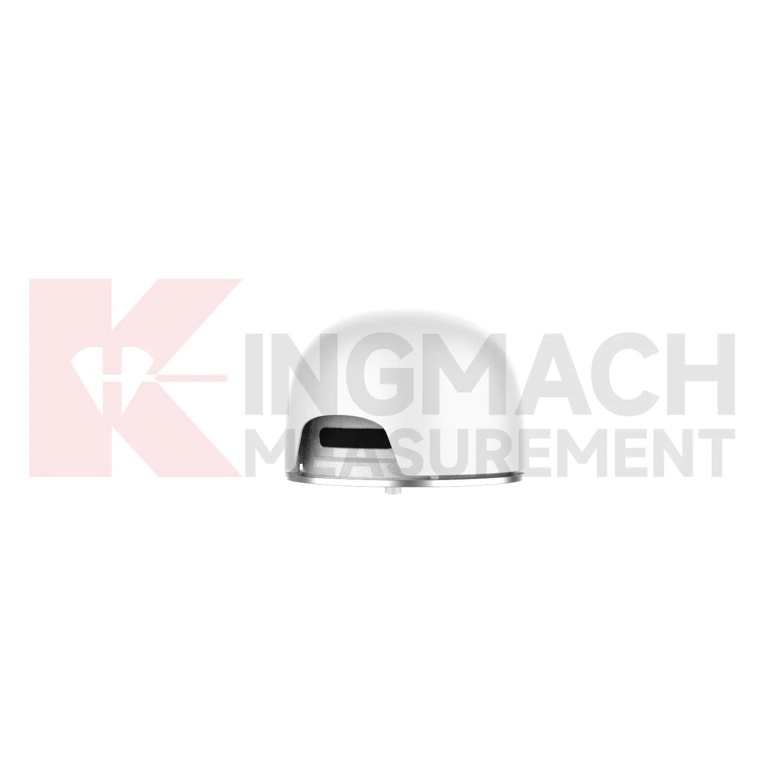
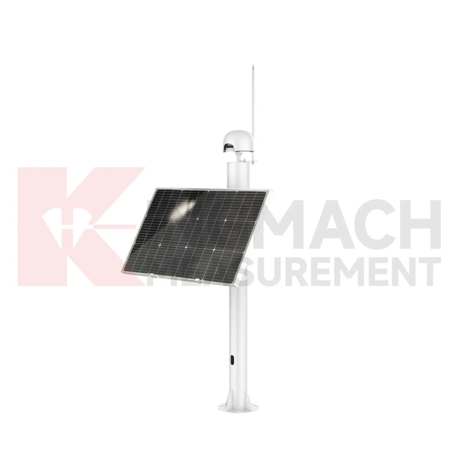
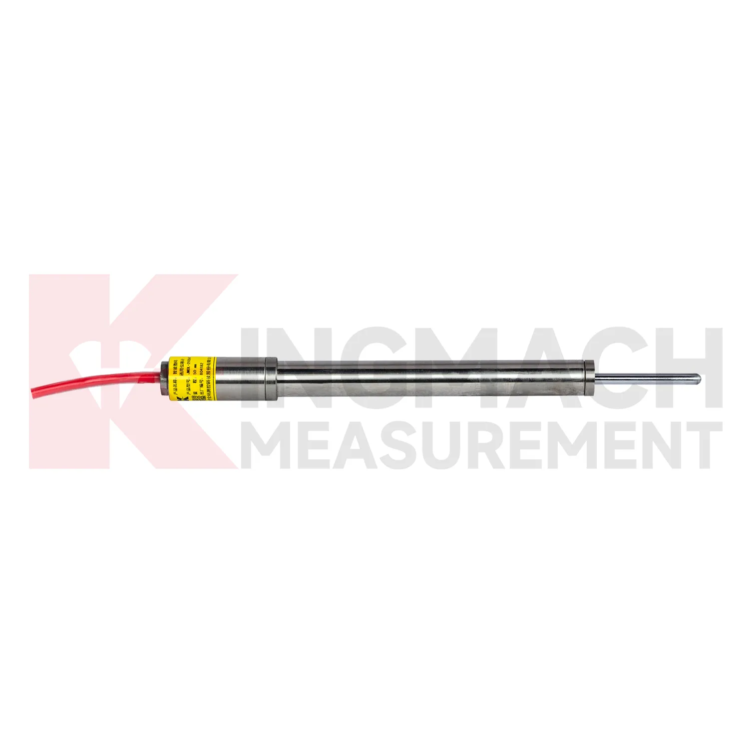
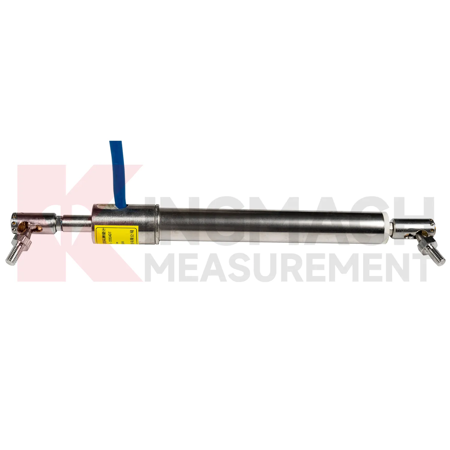
In slope and landslide monitoring, GPS Displacement Monitoring System are used to detect surface creep, deep sliding, retaining wall movement, crack expansion, and displacement between fixed reference points. The challenge is that slope movement may be slow for weeks and then accelerate after rainfall, excavation, blasting, or traffic vibration. Kingmach JMDL-31XXAT multipoint meters can anchor several depths and separate shallow movement from deeper rock layer displacement. JMDL-32XXAT bedrock meters provide single-point embedded measurement with 50 mm, 100 mm, and 200 mm ranges, 0.01 mm resolution, 0.5%FS accuracy, and -30 degrees Celsius to +80 degrees Celsius operating temperature. JMLS-22XXADT wire rope sensors support 500 mm to 2000 mm movement paths with IP67 sealing. When these readings are reviewed with rainfall, pore pressure, tilt, and GNSS data, engineers can identify whether the slope is stable, creeping, or moving toward a warning threshold. During operation, the monitoring team should keep the baseline, temperature, inspection notes, and nearby sensor behavior in the same review file. This makes it easier to tell whether a movement trend comes from normal service, a repair event, changing load, water influence, or developing structural risk. Clear records also help owners decide when a field inspection is needed instead of waiting for visible damage.
The future of GPS Displacement Monitoring System
Future GPS Displacement Monitoring System will also become easier to install in cramped and irregular field locations. Many monitoring points are not clean laboratory setups; they are narrow tunnel headings, wet dam galleries, crowded bridge joints, temporary formwork frames, steep slopes, and machinery spaces with limited room for tools. Smaller housings, clearer mounting accessories, stronger cable exits, and simpler alignment checks will reduce installation errors. Kingmach already uses several physical formats, including crack gauges with measuring rods and bases, draw-wire sensors for longer travel, embedded bedrock assemblies, flexible geogrid meters, and non-contact magnetostrictive meters. Future product development can make these formats more modular, so engineers select the mounting kit, cable protection, connector type, and acquisition method together. That would shorten commissioning time and make later maintenance less dependent on the original installer. For projects with many measurement points, practical installation improvements can be as important as another decimal place of resolution, because a well-mounted sensor gives cleaner data from the beginning.
Care & Maintenance of GPS Displacement Monitoring System
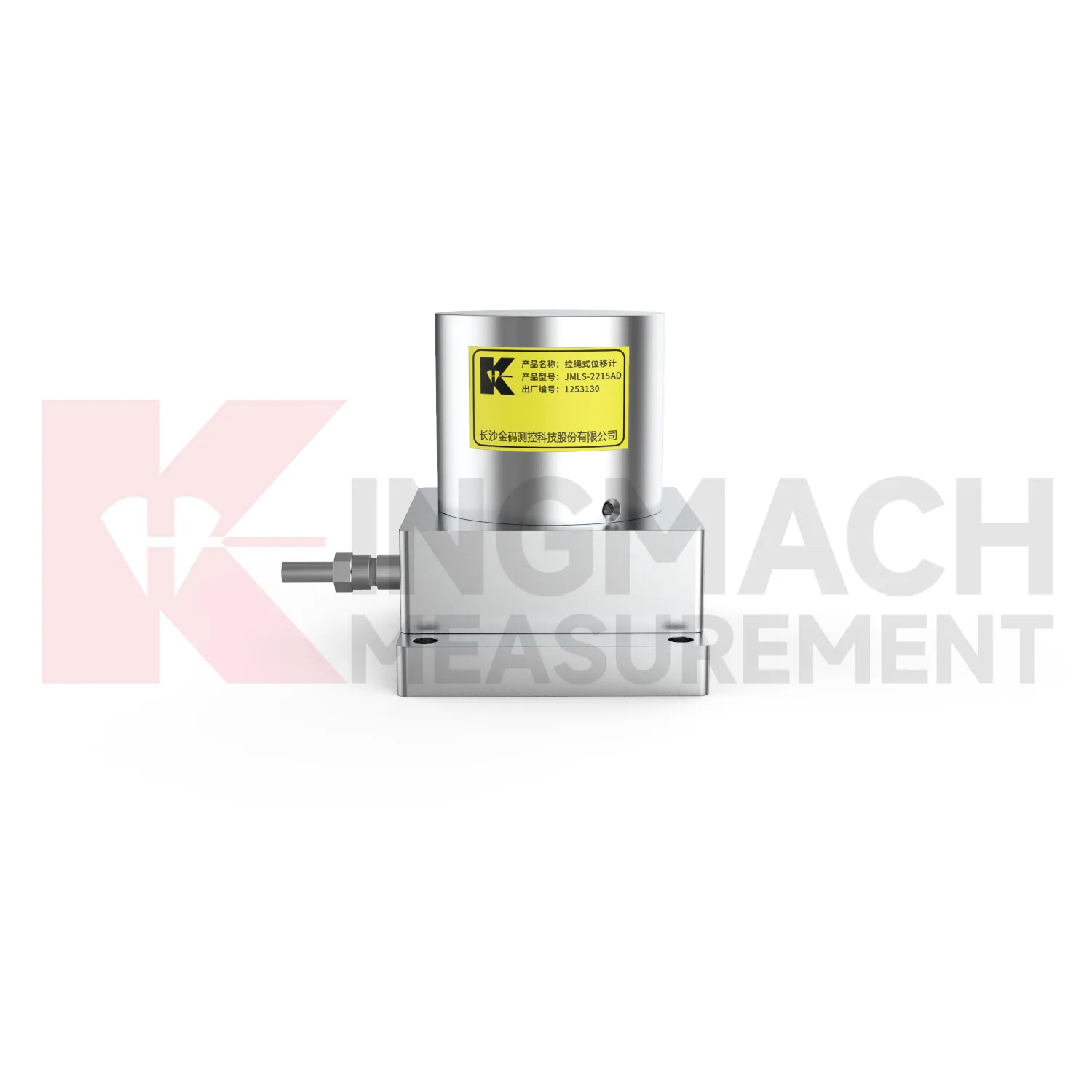
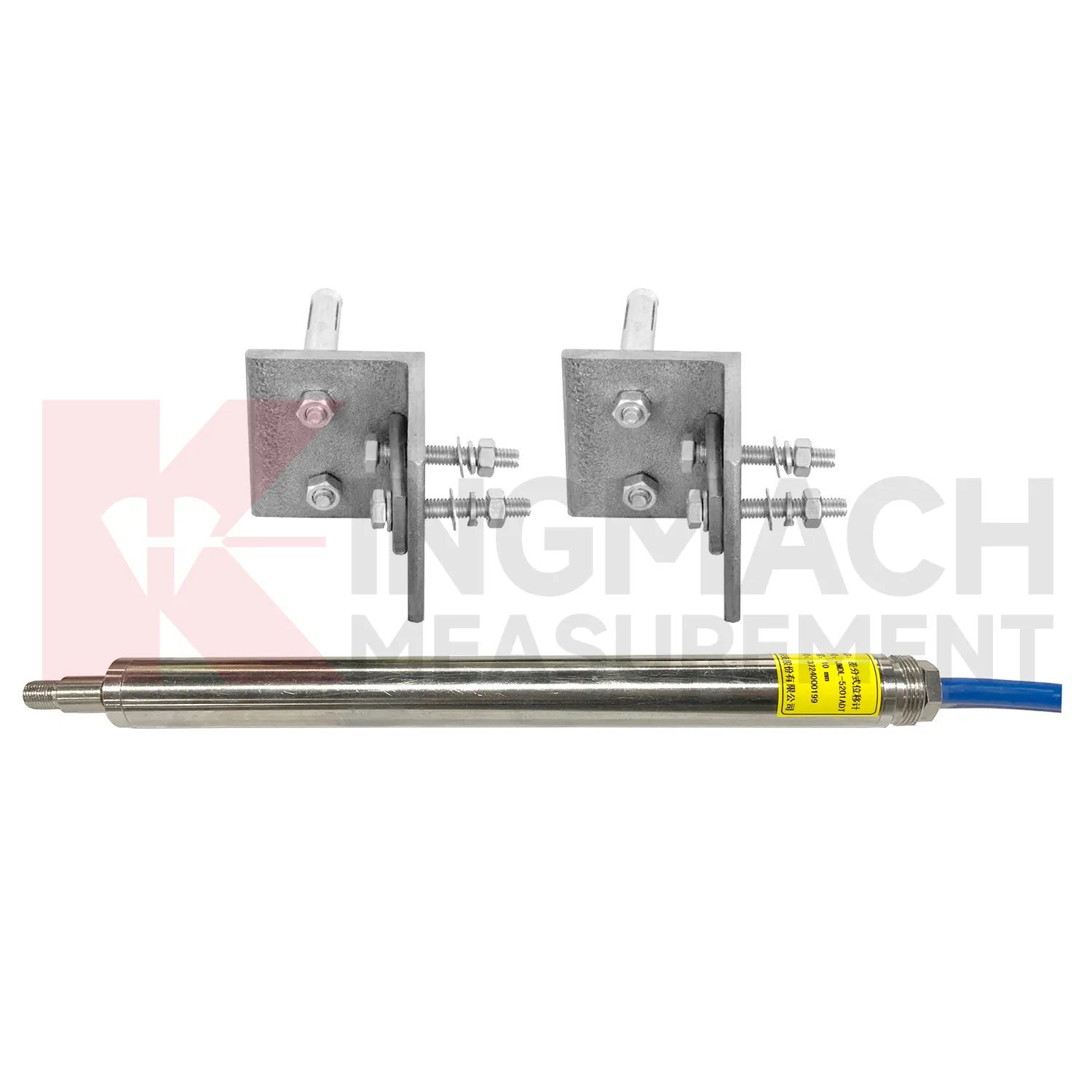
For differential GPS Displacement Monitoring System, maintenance should preserve the geometry that makes high precision possible. Kingmach JMDL-52XXADT uses two coupled inductive coils to reduce environmental interference and thermal drift. The product lists 20 mm, 50 mm, and 100 mm ranges, 0.01 mm resolution, plus or minus 0.1%FS accuracy, RS485 output, low power consumption, and -40 degrees Celsius to +80 degrees Celsius operating temperature. During installation, align the measuring rod so it moves freely without side load or rubbing. Protect the device from impact at expansion joints and from water pooling around connectors. During service, compare readings across temperature cycles and confirm that movement returns as expected when the structure cools or unloads. A persistent offset may indicate structural change, bracket movement, or cable trouble. Keep yearly stability checks and calibration records with the monitoring database, not only in paper files. Keep the installation photo, point number, zero value, and expected movement direction with the commissioning record for later review. If a reading changes after maintenance work, inspect the base, anchor, cable, and cabinet before assuming the structure itself has moved.
Kingmach GPS Displacement Monitoring System
GPS Displacement Monitoring System support safer engineering decisions when the reading is tied to a clear location, a known baseline, and a repeatable acquisition method. Kingmach products list practical field details such as 0.01 mm resolution on several JMDL models, 0.5%FS accuracy on general-purpose, crack, flexible, and formwork models, plus 0.1%FS accuracy on the differential JMDL-52XXADT series. Protection ratings such as IP67 and IP68 help when instruments are exposed to dust, water, concrete work, or outdoor cabinets. RS485 output on digital models allows remote data transfer, while memory functions keep calibration and measurement data close to the sensor. In bridges, buildings, hydropower works, tunnels, railways, slopes, and foundation pits, those details reduce the gap between a specification sheet and actual monitoring work. The better the field record, the faster abnormal movement can be checked. The point should be named on the drawing, linked with its cable route, and checked against the expected movement direction before the first automatic reading is accepted. For daily review, the reading should be compared with nearby points, recent weather, site operations, and any loading event that could explain the movement.
FAQ
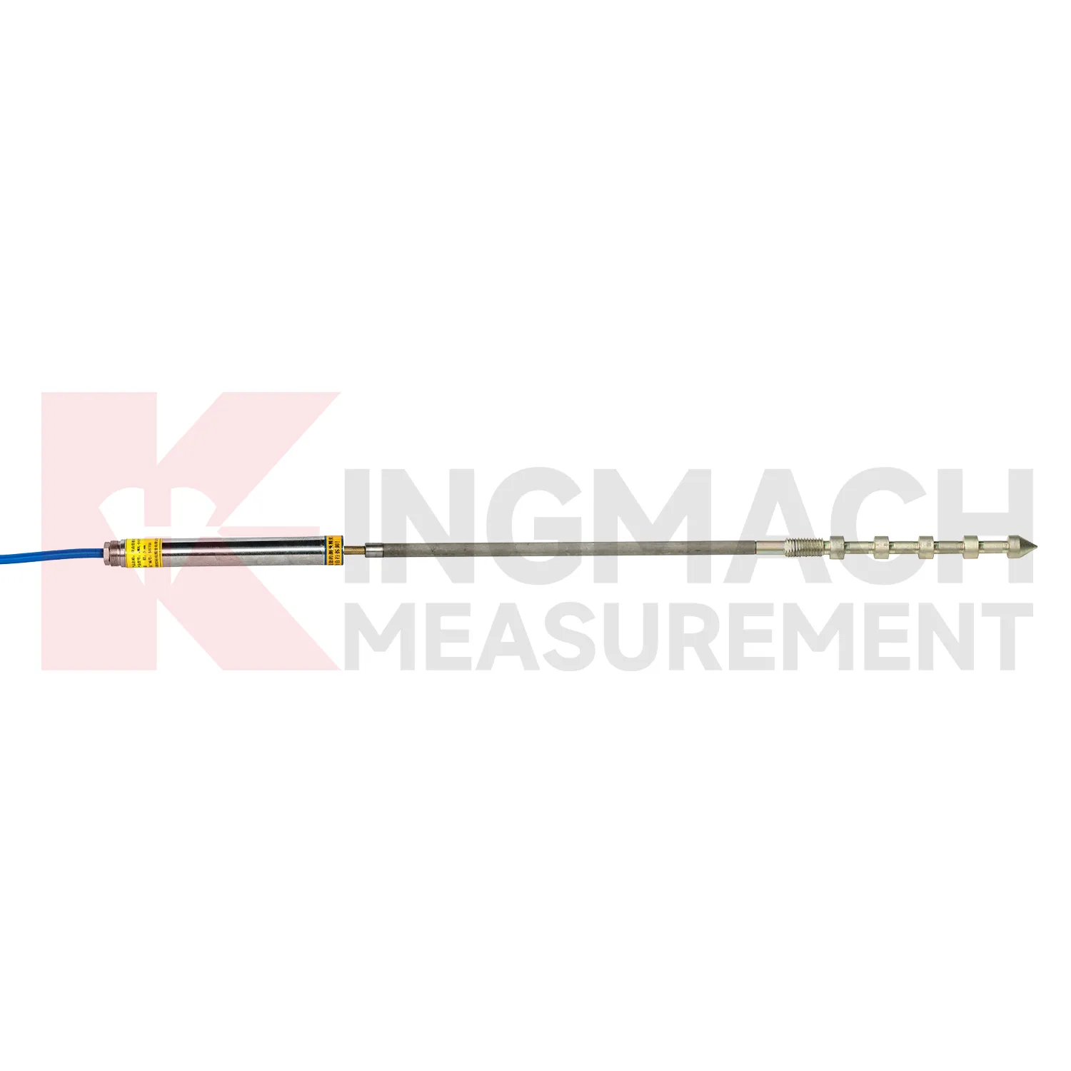
Q: Which GPS Displacement Monitoring System fit crack monitoring?
A: The JMDL-22XXAT Smart Crack Gauge is designed for cracks, joints, and expansion joints in bridges, buildings, roads, railways, dams, tunnels, and slopes.
Q: What ranges does the crack gauge list?
A: Listed models include 20 mm, 50 mm, 100 mm, and 200 mm ranges, with 0.01 mm resolution on the 20 mm to 100 mm versions and 0.05 mm on the 200 mm version.
Q: How many records can the crack gauge store?
A: Product information states that it can save up to 600 measurement results, including time, temperature for temperature versions, displacement values, and zero-point value.
Q: What installation details matter most?
A: Base stability, rod alignment, connector sealing, cable protection, and a clear zero reading matter more than a polished-looking installation.
Q: Can it be used for long-term observation?
A: Yes. The product is described for long-term monitoring, especially where crack width changes need stable and repeatable measurement.
Reviews
David Wilson
We purchased displacement transducers and settlement sensors, and the quality exceeded our expectations. Easy installation and reliable performance.
Matthew Garcia
Instrumentation cables are durable and perform well even in harsh environments. Will definitely order again.
Latest Inquiries
To protect the privacy of our buyers, only public service email domains like Gmail, Yahoo, and MSN will be displayed. Additionally, only a limited portion of the inquiry content will be shown.
Olivia***@gmail.comUnited States
Hello, we are currently sourcing high-precision strain gauges and load cells for a bridge monitoring...
Charlotte***@gmail.comUnited Arab Emirates
Hi, we require instrumentation cables suitable for harsh environments. Could you advise on specifica...